The history of Metro Manila’s railway system from the late 1800s to the present can be better appreciated by both academics and the general public if all these implemented projects and proposed plans are rendered visually through maps. A visual rendering of both completed and planned but never implemented rail projects can become a means for both policy-makers and the general public to have a better understanding of the history of mass transport planning and implementation in Metro Manila in the recent past. In addition, the use of Geographic Information System (GIS)-based know how in this project can help introduce to social science scholars, particularly historians and historical geographers, the potential of GIS as a research tool to maximize the usability and explanatory value of available archival data. See download section for more GIS resources.
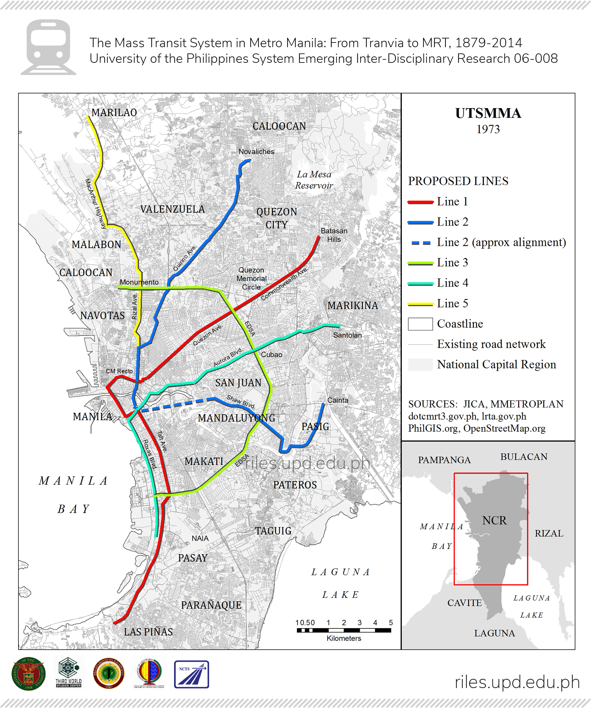
UTSMMA (1973)
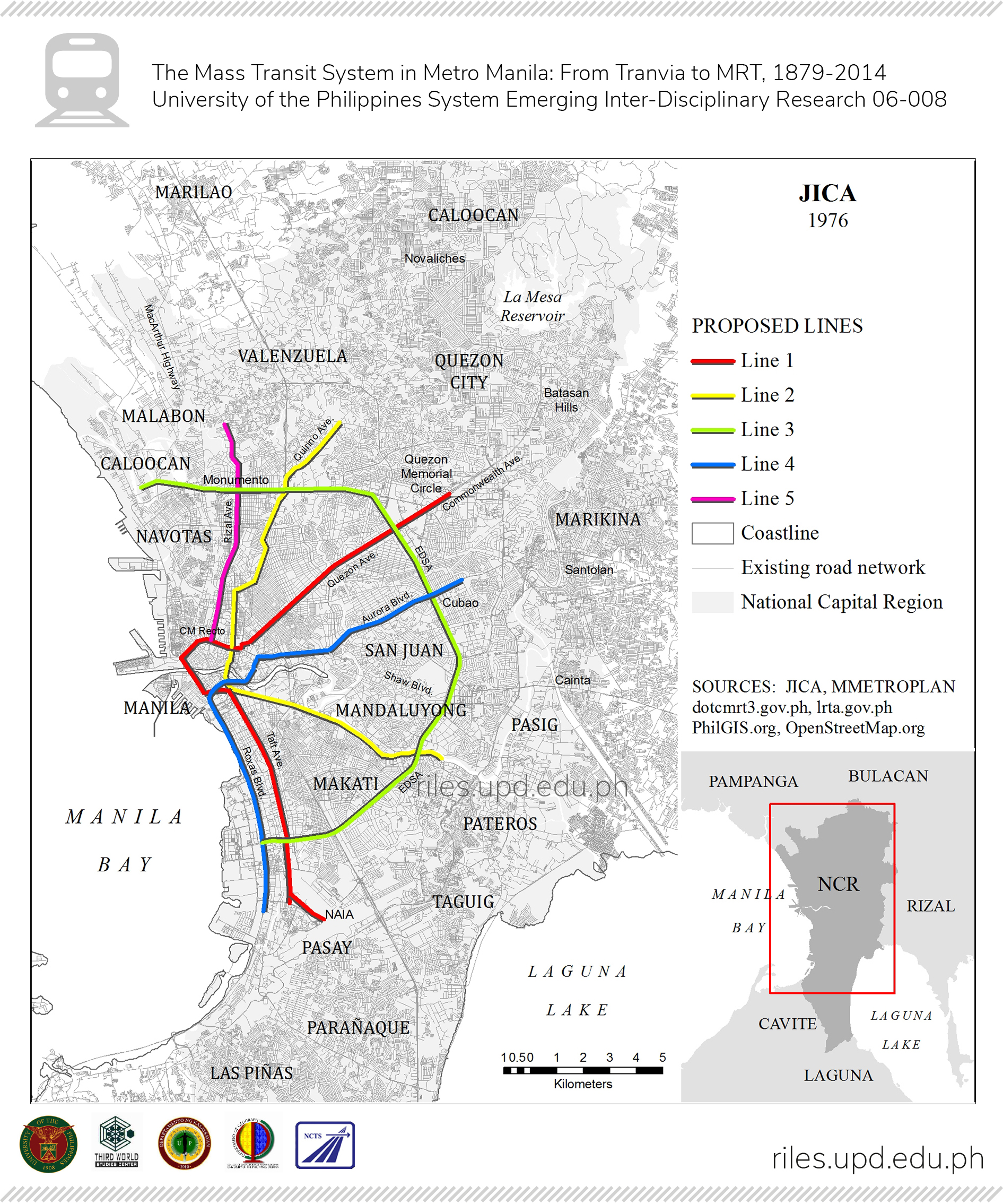
JICA (1976)
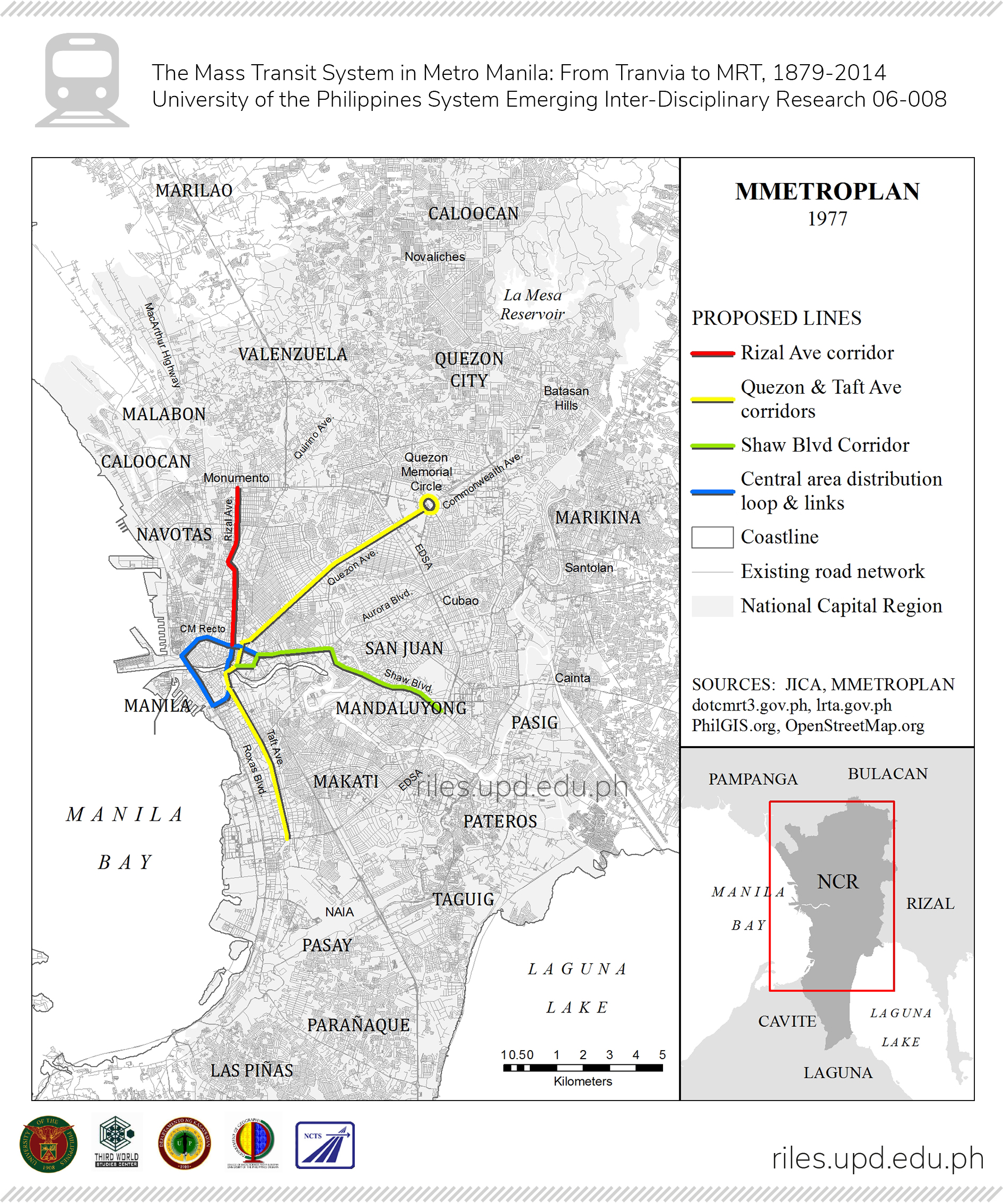
MMETROPLAN (1977)
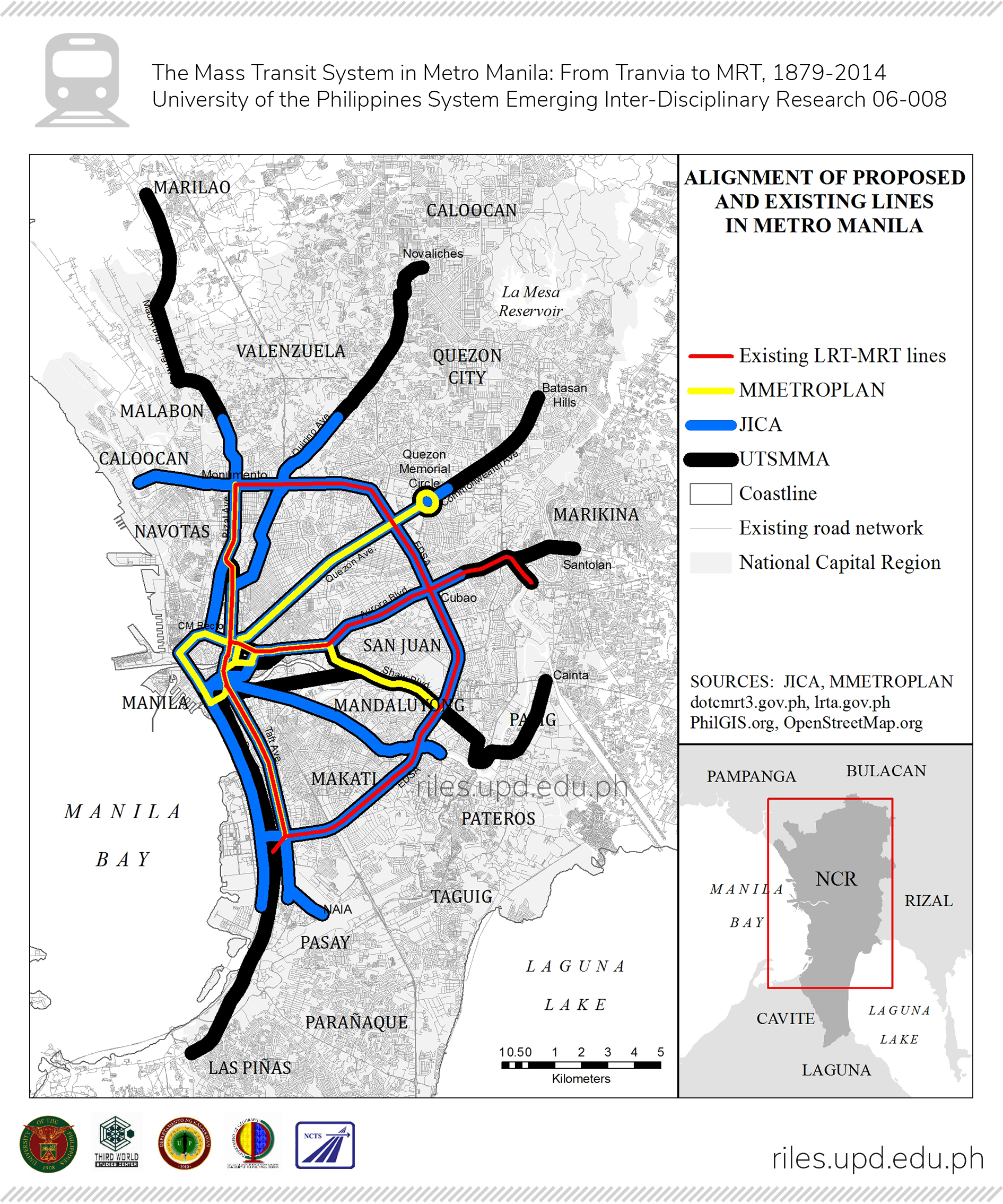
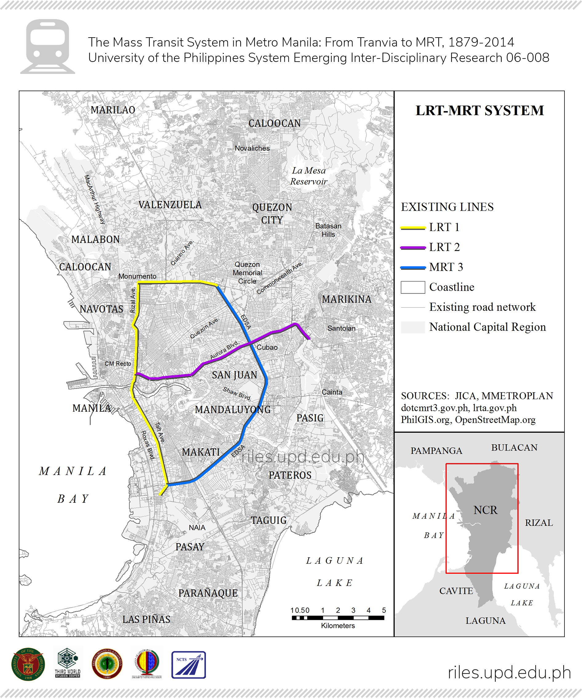
LRT-MRT System
Alignment of Proposed and Existing Lines in Metro Manila